Where did the map come from?
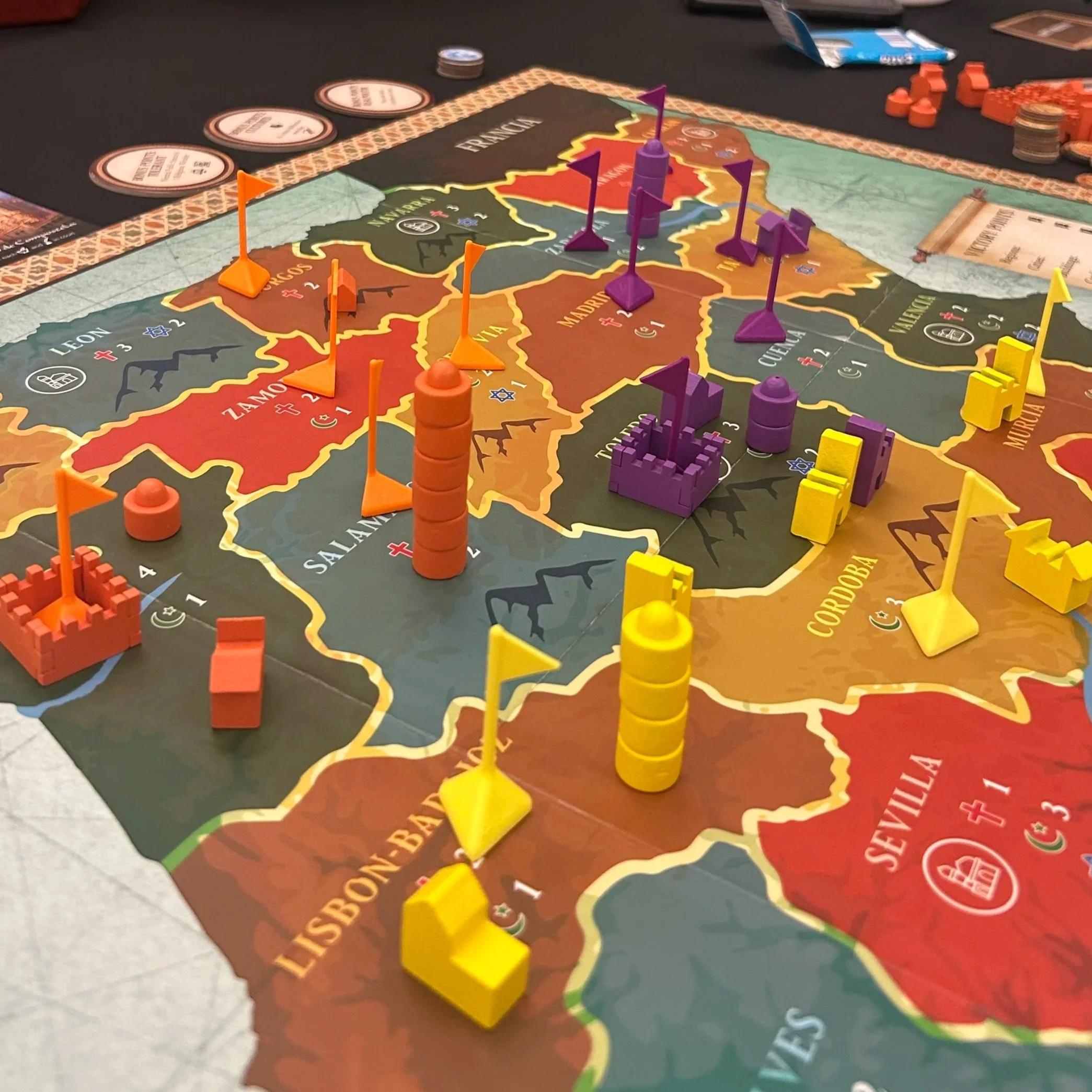
Current version of the Iberia: Kings and Emirs Board Game Map
The Creation Story of Our Game Board
Our map always draws people in. And recently, along with the countless compliments about its design, we’ve received a few questions about the logic behind it. The design process was like balancing on a teeter-totter between accessibility and accuracy. I wanted to make the map as accurate as I could: geographically representative, illustrative of the political boundaries of the time, and a reflection of the demographics of the era.
The challenge? There are no maps from the 11th century that detail the various kingdoms and Taifas of the time. The concept of a modern “state” with fixed borders was not yet developed. Raiding across territories was a common tactic, and kingdoms rapidly expanded, declined, and moved back and forth as different leaders vied for control. In this era, territorial control was a relative concept.
I scoured the internet and my books for maps. And, just like many shifts in power during this period, each map was significantly different, depending on the year it was attempting to capture or the aspect of history the author was focusing on. Because of the sweeping history I wanted the game to simulate, I chose to break the map down into regions that represented the most influential population centers of the time, rather than the kingdoms and emirates themselves.
Accessibility: A Relatable View of a Complicated Time
As I designed the map, I wanted to create a visual representation of the time that was also relatable to a modern player. The dramatic geography of the peninsula and the dispersion of power meant countless kingdoms were created when the caliphate collapsed. For practical reasons, I couldn't include all the different kingdoms, provinces, and localities that existed over time.
I wanted players to see locations and shapes that would feel familiar. So, to start it off, I used a beautiful tile map from the Alcazar de Segovia by Juan Ruiz de Luna, which has a modern Spanish structure.
Accuracy: Peeling Back Layers of History
I then peeled back some regions, combined others to represent the primary regions of the era, and made some hard calls about downplaying major power centers (Zaragoza, for example). The maps from this website were invaluable, while the Wikipedia page on Taifas was also a useful resource for maps.
The final result allows players to rewrite history while responding to many of the same demographic, economic, and political incentives that rulers faced at the time. What if Toledo didn’t control Cuenca and Guadalajara, but went west and took Porto-Badajoz? What if León was able to unite with Navarra earlier in history?
Recent gameplay from MaricopaCon ‘25
In the end, I’m thrilled with where it landed. I’ve met with a number of medieval historians and experts on the time, and all have given their blessing to the work and its job of balancing these different priorities. Interestingly, I’ve gotten more comments from experts about the nuances of population demographics—like adding a Muslim population here or removing a Christian population there—than I have about the political boundaries drawn. What I created isn't a static painting of what people might naturally expect; it's a dynamic canvas for you to paint your own political history in the realities of the period.
Finally, credit must be given for the beautiful design of the board to Jon Nicol, my dear friend and incredible graphic designer. Check out his work here.


